
If you’re heading to Basingbourne Park, why not give yourself a bit more of a challenge by printing out our orienteering map and finding your way around our Permanent Orienteering Course.
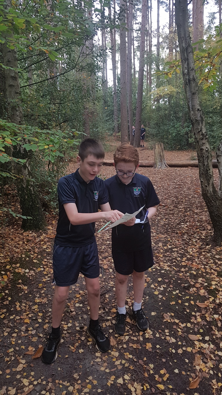
The objective is to use a map to locate a series of control points (marked with a red and white square) and then get back to the start/end as quickly as possible.
The “Start” is shown as a Triangle on the map and is located at the end of the Car Park.
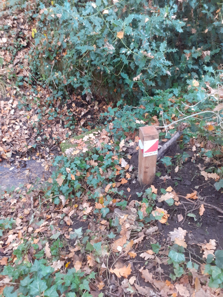
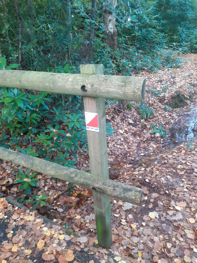
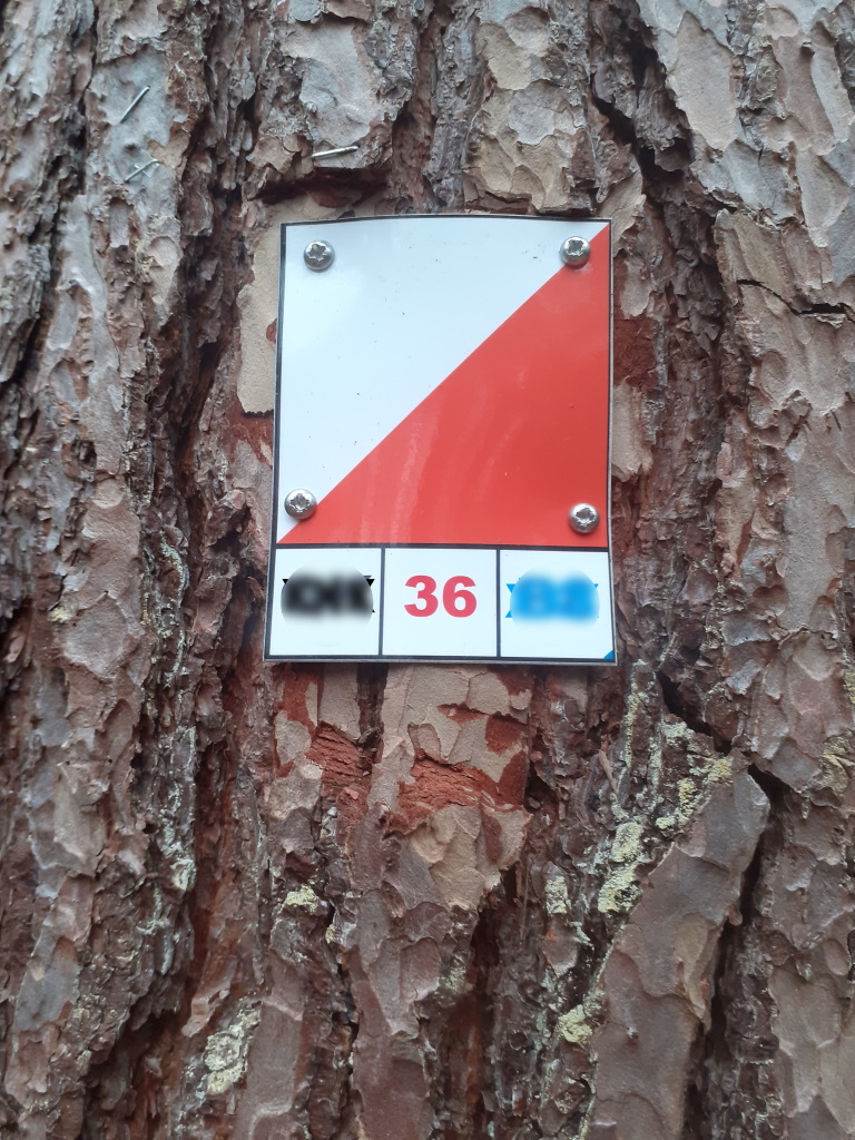
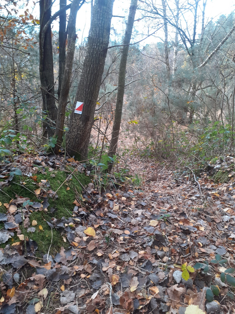
The checkpoints or “Controls” are features marked by red circles on the map and have corresponding red & white markers on or near the feature in the park. The markers are either on the feature itself (like a fence or bridge), or on a tree or post very close to it.
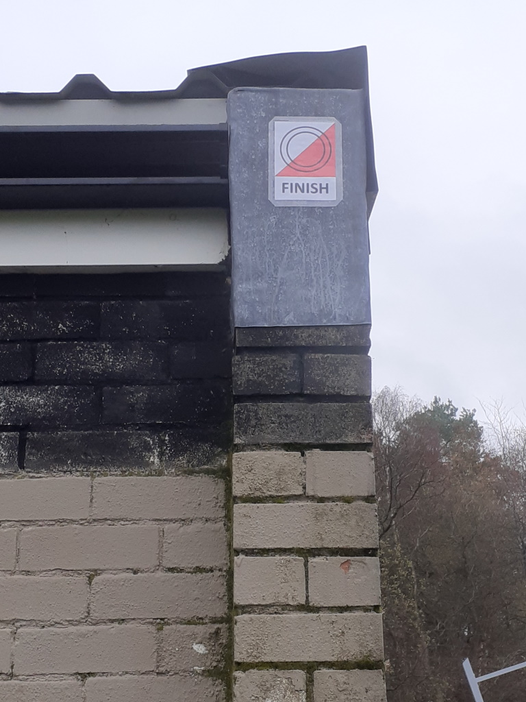
The “Finish” is shown as a Double Circle on the map (with a corresponding marker on the Pavilion).

Instructions
Choose one of the maps below (either one of our “Suggested Courses” or the “All Controls” map).
For the “Suggested Courses” simply follow the course marked on the map. For the “All Controls” you can make up your own route, or just see if you can find all the controls.
These are standard orienteering maps; the symbols and colours are explained in the legend at the top right of the page. The scale is approximately 1:2500 which means that 1cm on the map represents 25m on the ground.
Suggested Course Maps
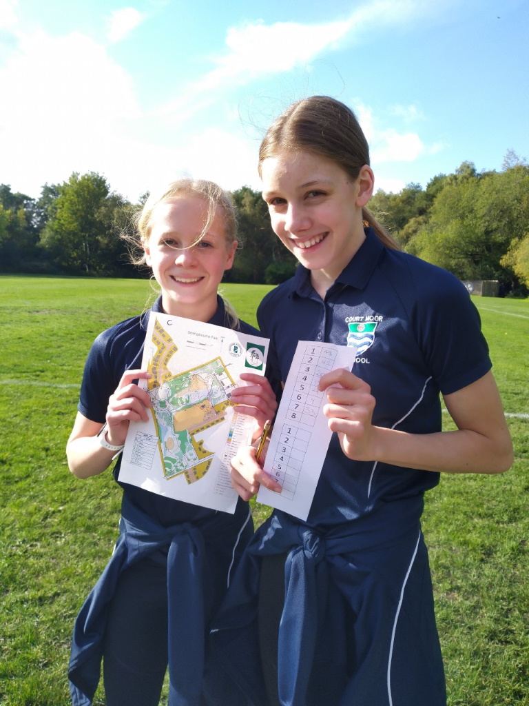
These ready to use route maps only show the checkpoints for a specific route. The numbers on the map is the order in which you should visit the controls. Use the descriptions in the bottom right hand box to help identify the feature you are seeking. When you find the feature, locate the control marker and check that the red number on the marker matches the second number in the description box. Why not start with the easiest and work up? Choose one to print out and you’re ready to go:
STARTER – EASIEST & SHORTEST
EASY SHORT
EASY LONGER
HARDER SHORT
HARDER LONG
“All Controls” Orienteering Map
You can visit controls in any order and any quantity you like. So, you can make up your own routes or just see how quickly you can find all the controls! The control number on the “All Controls” map corresponds to the red number on the marker in the park, so you know you have navigated to the correct place. Use the control description box at the bottom right of the sheet to help identify and navigate to the feature.
If you are competing with friends, family or another group, then you also need to record either the Black or Blue codes from each Checkpoint to prove you’ve visited each checkpoint. Then move onto the next checkpoint, and finally return to the End (Double Circles marker) at the Pavilion.
Hints and Tips
Look carefully at the map to work out the best route. For example, it may be faster to follow a path the long way around than to go directly through rough terrain. And whilst you may be able to jump a stream, it may be safer and drier to use a bridge.
Align your map with the landscape to ensure you are heading in the right direction. You could use a compass for this, but within the Park you should be able to do this by looking for main features. Remember to check several features in different directions to be sure of your location on the map.
As you move to different controls, identify features on the map that you expect to see on your way. This will help ensure you are going in the right direction and give you an early warning if you are going wrong.
If you do get lost, don’t worry. Even the best orienteers can get lost. Look around you for major features, find them on the map, and work out your new route.
Health & Safety
Whilst the Park is generally a safe environment, when using the orienteering course we ask you to take care:
- Uneven paths and trip hazards (particularly when off paths)
- Watch out for low sticks/branches and things like brambles and nettles
- Take care when near water (bridges/ditches/pools and the canal)
- Take care during wet or icy conditions as paths and surfaces may become slippery
- Avoid the woods during high winds, due to risk of falling trees or branches
- After using the heath and woods, check yourself and your children for ticks. Remove with tick fork and seek medical advise if a bullseye rash develops
Group Users
We would ask any groups planning to use the orienteering course to let us know via an email to info@basingbournepark.org.uk for supporting material and so we are aware of usage. You should complete your own risk assessment, but we can provide a proforma risk assessment as a starter. You should walk the course to check all markers are present (as unfortunately they can be subject to vandalism).
Any groups planning to use the course for more than a one-off activity are also advised to seek authorisation from Fleet Town Council.
When teaching orienteering skills, we recommend initially undertaking a “star” exercise – i.e. sending individuals or small teams to find a single checkpoint in the main sportsfield/park area, and then one in the woods (to verify they can use the map with confidence), before attempting a full course.
Our markers contain a black alphabetic check code (left) and a blue alphanumeric check code (right), so different groups can be assigned to the same route
but collecting different colour codes and different groups can also be sent around a route in opposite directions so that a number of groups can use the course simultaneously but without just following each other.
Acknowledgements
We would like to thank the following for their support:
- Fleet Town Council for maintaining the Park and for their continuing support to FoBP
- Southern Navigators for their help and support creating our Orienteering Course
- Hampshire County Council (and Councillors John Bennison and Steve Forster) for County Councillor Grants use to purchase materials and equipment for this course and other projects.
Further Orienteering Opportunities
If you enjoy orienteering at Basingbourne Park, you may also want to try out the orienteering course at OAKLEY PARK.
If you would like to do more orienteering contact the local club, by visiting the SOUTHERN NAVIGATORS website.